
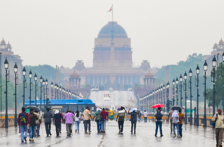
Weather conditions in India are changing once again due to an active western disturbance, resulting in light to moderate rainfall and lower daytime temperatures in parts of North and Northwest India. The India Meteorological Department (IMD) has issued storm warnings for 11 states, including Delhi, Uttar Pradesh, and Bihar, with wind speeds expected to reach up to 85 kmph. A yellow alert has been issued for Delhi, indicating possible rainfall, thunderstorms, and gusty winds.
The impact of this weather disturbance is also anticipated in hilly regions, with Jammu and Kashmir and Himachal Pradesh facing potential risks of landslides and avalanches due to the changing weather patterns. The increased wind activity is likely to bring down minimum temperatures by 2 to 3 degrees Celsius, resulting in cooler conditions, especially during morning and evening hours.
The IMD has forecasted a yellow alert for Wednesday in the Delhi-NCR region, predicting cloudy skies, strong winds, and intermittent rainfall. Thunderstorm activity is expected in isolated areas, with occasional rain or storm conditions during the day. In Delhi, temperatures are expected to range from around 16 degrees Celsius as the minimum to approximately 27 degrees Celsius as the maximum.
Looking ahead, Thursday is likely to have partly cloudy skies in the capital. Weather conditions are expected to improve gradually from April 10 to 11, with clearer skies and a gradual rise in temperature. Maximum temperatures during this period may reach 33 to 34 degrees Celsius. Uttarakhand districts such as Dehradun, Nainital, Chamoli, and Pithoragarh are expected to experience light to moderate rainfall on April 8 and 9, along with winds up to 60 kmph.
Similarly, districts in Himachal Pradesh, including Shimla, Kullu, Mandi, Kangra, and Kinnaur, are likely to receive moderate to heavy rainfall between April 8 and 10 due to the continued influence of the weather system.