
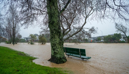
Waves up to 11 meters and strong winds struck Wellington, New Zealand’s capital on Tuesday, leading to mandatory evacuations in some areas and disruptions to transport services. Residents in Owhiro Bay, Island Bay, Houghton Bay, and Breaker Bay were instructed to vacate waterfront properties due to the severe weather conditions. The Wellington Region Emergency Management Office reported coastal roads being overtopped by swells and wind gusts of nearly 100 km/h at Wellington Airport.
Flights to and from Wellington were impacted, with multiple cancellations and a small aircraft being overturned. Both Interislander and Bluebridge ferry services across Cook Strait were halted as well. MetService noted that while average wave heights were about six meters, peak waves were almost double that height. The extreme weather was forecasted to continue into Tuesday afternoon before easing later in the day, with evacuation orders remaining in effect until Wednesday morning.
Authorities enforced road closures along the south coast and advised the public to avoid exposed coastal areas. Officials warned of potential significant coastal damage from the long-period swells, surpassing the impacts of a 2020 storm with 5.5-meter waves that led to widespread evacuations. New Zealand’s geographical location exposes it to frequent heavy rain, influenced by prevailing winds, low-pressure systems, rugged terrain, and rising sea temperatures. The country’s position in the southwest Pacific Ocean, surrounded by water on all sides, ensures a continuous moisture source carried inland by winds.