
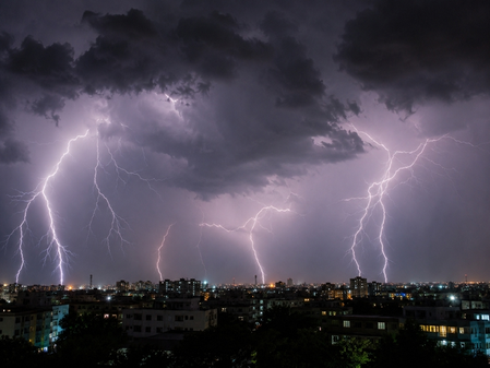
The India Meteorological Department (IMD) has issued a fresh thunderstorm alert for several parts of Madhya Pradesh on Sunday evening as the Southwest monsoon continues its northward advance. Moderate thunderstorms with lightning and strong gusty winds up to 60 kmph are expected in areas like Harda, Sehore, Dewas, Khandwa, and Omkareshwar. Additionally, light to moderate thunderstorms with lightning and winds up to 40 kmph are forecasted in many other districts across the state.
According to the daily weather summary, Madhya Pradesh witnessed scattered rainfall in the past 24 hours. The Bhopal division experienced rain in multiple places, while Narmadapuram and Shahdol divisions saw rain in a few locations. Isolated rainfall was reported in divisions like Indore, Ujjain, Gwalior, Chambal, and Rewa, with the remaining regions mostly dry. Notable rainfall amounts were recorded in various stations, including Nusrulgunj, Itarsi, and Kusmi.
Day temperatures in the state showed minimal change, remaining below normal in several divisions. The highest maximum temperature was 42.5°C in Nowgong (Chhatarpur), while the lowest minimum temperature dropped to 20.2°C in Pachmarhi (Narmadapuram). Monsoon progress has been observed in parts of West-Central India and the Northeastern states, influenced by a cyclonic circulation over East Uttar Pradesh and a trough extending to Telangana.
Conditions are favorable for further monsoon advancement in the upcoming days, with thunderstorms and strong winds expected in various districts. Farmers are advised to take precautions to protect livestock and crops, while motorists should exercise caution due to reduced visibility. A gradual rise in temperatures by 2-3 degrees Celsius is anticipated over the next four days. Residents are urged to stay updated with official alerts and adhere to safety measures to mitigate risks from lightning and strong winds.