
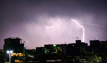
The India Meteorological Department in Bhopal has released a detailed weather bulletin highlighting significant atmospheric instability in Madhya Pradesh. The state is currently experiencing hailstorms, thunderstorms, and lightning, expected to continue for the next 24 hours. Various regions have already witnessed different levels of rainfall, with Badarwas leading at 16 millimeters, followed by Patharia and Majhgaon at twelve millimeters each.
Intense wind gusts have also affected the state, with speeds reaching 80 kilometers per hour in Sagar and 67 kilometers per hour in Ashoknagar. The department has issued high-alert warnings for specific regions, with thunderstorms, lightning, hailstorms, and strong wind gusts of 50 to 60 kilometers per hour expected in districts like Datia, Bhind, Chhindwara, and others between May 8 and May 9.
Neighboring areas such as Gwalior, Morena, Rewa, Jabalpur, and Sagar are on alert for similar weather conditions but with slightly lower wind speeds of 40 to 50 kilometers per hour. The forecast for the coming days shifts focus to southern and eastern regions like Betul, Anuppur, Chhindwara, and Seoni. Several districts have already experienced rainfall, thunderstorms, and hailstorms, with areas like Morena, Shivpuri, and Chhatarpur being hit by actual hailstorms.
The prevailing weather conditions are influenced by various synoptic systems, including a Western Disturbance over northwest Uttar Pradesh and adjoining Uttarakhand. Authorities have issued safety guidelines to mitigate potential damage to crops, livestock, and structures. Farmers are advised to secure crops, while the public is urged to stay indoors during lightning strikes and take precautions against power surges. A health advisory has also been issued to combat seasonal illnesses during erratic weather.