


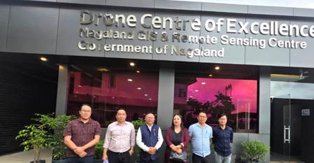
The Nagaland GIS and Remote Sensing Centre (NGISRSC) has played a crucial role in enhancing evidence-based planning and sustainable development in the state. The Senior Project Director highlighted key initiatives such as Village Resource Mapping, hydropower potential assessment, urban mapping at a detailed level, and various other geospatial projects. Nagaland’s Principal Secretary and Development Commissioner, Y. Kikheto Sema, visited the NGISRSC to acknowledge its significant contributions to informed decision-making and sustainable development.
Sema praised the NGISRSC for its extensive geospatial database and technical expertise, emphasizing the importance of utilizing these resources for effective implementation of government programs. He suggested evaluating Nagaland’s solar power generation potential integrated with the power-grid network for efficient energy planning. Additionally, Sema recognized the employment opportunities in the drone sector and urged the Centre to expand skill-development programs for youth employment.
The Principal Secretary highlighted the need for research, innovation, and indigenous drone design to cater to Nagaland’s unique requirements. He noted that such efforts would enhance technological self-reliance and position Nagaland as a hub for drone technology in the region. Sema was briefed on the activities of the Drone Centre of Excellence–Drone School, including training programs in drone operations, repair, maintenance, GIS mapping, and cinematography.
Officials informed Sema about the ongoing training programs at the Centre, with plans to start DGCA-certified drone training courses in August 2026. During his visit, Sema toured the Centre’s facilities, including the drone assembly laboratory and repair unit, to understand the complete drone development process. He was briefed on the efforts to build a skilled workforce and strengthen the state’s geospatial and drone ecosystem.
