
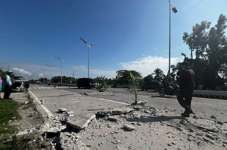
A powerful 7.8 magnitude earthquake struck the waters in the southern Philippines on Monday morning, as reported by the Philippine Institute of Volcanology and Seismology. The earthquake, of tectonic origin, occurred at 7:37 a.m. local time at a depth of 33 km, with its epicenter located 32 km southwest of the coast of Maasim town in Sarangani Province on Mindanao Island. Following the quake, a tsunami warning was issued for nine coastal provinces, urging residents to evacuate to higher ground or inland immediately.
The first tsunami waves are expected to hit on Monday morning and persist for several hours. Reports from local media indicated that the earthquake caused damage to some buildings, triggered power outages, and led to tremors felt in nearby provinces. Fortunately, there were no immediate reports of significant damage or casualties in Indonesia or the Philippines, although areas closest to the epicenter experienced intense shaking.
The earthquake occurred offshore near Mindanao, the Philippines’ second-largest island, known for being in a highly seismically active region. The Philippines, situated along the Pacific “Ring of Fire,” frequently encounters seismic events due to its location at major tectonic plate boundaries renowned for earthquakes and volcanic activities. Additionally, Indonesia’s Meteorology, Climatology, and Geophysics Agency issued an early tsunami warning for northeastern coastal areas following the earthquake in the southern Philippines.