
The Regional Meteorological Centre in Chennai has predicted the formation of a low-pressure area over the Bay of Bengal by Monday, potentially leading to rainfall in parts of Tamil Nadu and nearby areas. The India Meteorological Department mentioned the presence of an upper-air cyclonic circulation over the equatorial region and southeast Bay of Bengal, likely resulting in the formation of a low-pressure area over the south Bay of Bengal and equatorial Indian Ocean.
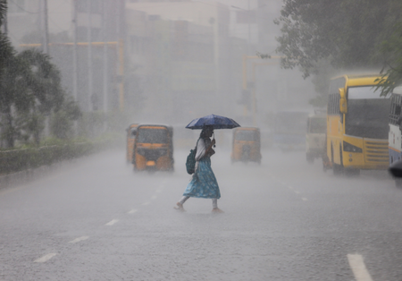
This weather system is expected to impact rainfall in Tamil Nadu, Puducherry, and Karaikal until February 21. While heavy rain is not expected on a large scale, some districts may receive light to moderate rainfall during this period. Meteorologists are closely monitoring the system for any signs of intensification.
The forecast indicates the likelihood of light to moderate showers in isolated areas across the state in the upcoming days. Coastal and northern districts, in particular, may witness cloudy skies and intermittent rain as the system develops over the Bay. Additionally, the IMD has forecasted moderate mist formation in a few locations on Sunday.
Areas such as Chennai, Tiruvallur, Kancheepuram, Chengalpattu, Villupuram, Cuddalore, and Puducherry are expected to experience misty conditions. Commuters in these regions have been advised to be cautious due to reduced visibility, especially during the early morning hours. Fishermen operating in the south Bay of Bengal and nearby waters are urged to stay updated on weather changes as sea conditions could vary based on the system’s evolution.
Officials have assured that further updates will be provided as the weather system progresses. The formation of low-pressure areas over the Bay of Bengal typically brings intermittent rainfall to Tamil Nadu, providing some relief from dry conditions in various districts. Residents are advised to stay informed by following official bulletins from the Regional Meteorological Centre for the latest weather updates and advisories.